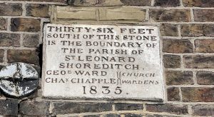
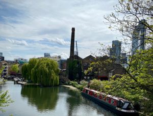
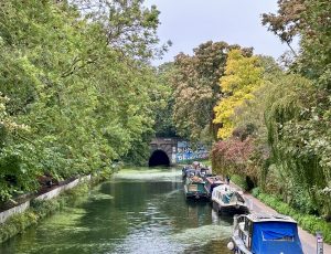
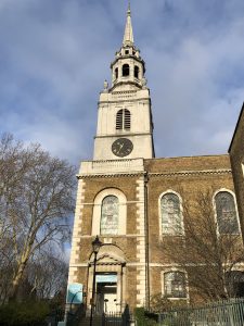
Shoreditch Park

booth_shoreditch

This map is taken from Charles Booth’s Poverty Survey in around 1898. Booth walked the streets of late Victorian London, accompanied by a local policeman, then produced maps and notebooks … Read more

Churches of the past

lost_church_de_beauvoir

This view, from around 1900, is looking south down Southgate Road N1 from near the junction with Englefield Road. The pub on the right is the Lord Raglan, now replaced … Read more

Historic Hoxton

shoreditch_vestry

Hoxton and Shoreditch today are often known as fashionable parts of east London, areas to eat out in and go clubbing. It’s also an area of astonishing contrasts from post … Read more

Historic Hoxton

shoreditch_vestry

Hoxton and Shoreditch today are often known as fashionable parts of east London, areas to eat out in and go clubbing. It’s also an area of astonishing contrasts from post … Read more

Clerkenwell’s Mediaeval Monasteries

St John's Gate

In medieval times Clerkenwell was an area of fields on the outskirts of the City of London, dominated by monastic institutions. The monasteries were all closed in the 1530s when … Read more

Whitbread Stables

whitbread_stables

Whitbread started brewing in Finsbury in 1742 and became very successful. By the late 1800s, they needed more stabling for their horses than they had room for at the huge … Read more

Clerkenwell’s Mediaeval Monasteries

St John's Gate

In medieval times Clerkenwell was an area of fields on the outskirts of the City of London, dominated by monastic institutions. The monasteries were all closed in the 1530s when … Read more