Hidden histories around Holborn

Fascinating and perhaps unexpected places lie either side of the busy main road of High Holborn. This was originally a continuation of a westward path up from a crossing over the … Read more
Fascinating and perhaps unexpected places lie either side of the busy main road of High Holborn. This was originally a continuation of a westward path up from a crossing over the … Read more

‘Beating the Bounds’ around the borders between parishes, land ownerships and similar is an ancient tradition, where the boundary was literally paced out and marked with stones each year. These … Read more

Clere Street is a turning off Tabernacle Street in Shoreditch, on the edge of the pre-1965 border between Finsbury and Shoreditch boroughs. It was previously called Paradise Street from c. … Read more
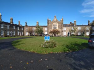
At Islington borough’s eastern edge, on the north side of Balls Pond Road, beyond the traffic bustle and behind railings, these old two-story buildings surround a tranquil green courtyard. They are … Read more

The above blue plaque in Whitecross Street, Finsbury, has recently been obscured by a new artwork. Whilst sad that we can no longer see it, the plaque itself was part … Read more
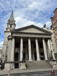
Set in a tight site on a busy road in Bloomsbury, St. George’s towers over the street below. It is Grade I listed, so in the top 2.5% of protected … Read more
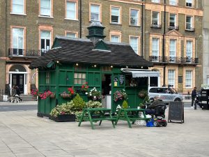
This cute green cab shelter at the north west corner of Russell Square is one of 13 (out of an original 61) that still survive in London. They were instigated … Read more
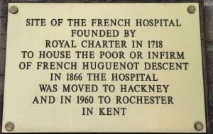
This discreet wall plate on a school in Bath Street, Finsbury commemorates the ‘French Hospital’, founded in 1718 close to the old City Pest House which housed sufferers from the … Read more
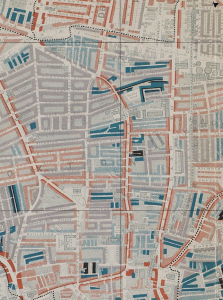
This map is taken from Charles Booth’s Poverty Survey in around 1898. Booth walked the streets of late Victorian London, accompanied by a local policeman, then produced maps and notebooks … Read more
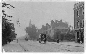
This view, from around 1900, is looking south down Southgate Road N1 from near the junction with Englefield Road. The pub on the right is the Lord Raglan, now replaced … Read more